

MH370 Airline Incident: The Disappearance of Malaysia Airlines Flight MH370 on March 8, 2014, is still one of the biggest aviation mysteries in the world and Google Maps has not been left out in the search for the missing plane.
The Boeing 777 with 239 passengers on board disappeared mid-flight from Kuala Lumpur to Beijing as the destination and this led to one of the largest search operations in history and many hypotheses about the plane’s whereabouts. Still up to this date, the aircraft has not been found and this has put the families of the passengers and crew in a lot of suffering.
MH370 Airline Disappearance and Initial Search
It was on the night of 8th March 2014 that MH370 took off from the Kuala Lumpur International Airport at 00:41 AM. The last communication with the air traffic control was at 1:19 AM when the plane flew from the Malaysian to Vietnamese airspace over the South China Sea. Soon after this, the aircraft’s transponder went off and the plane strayed off the designated course.
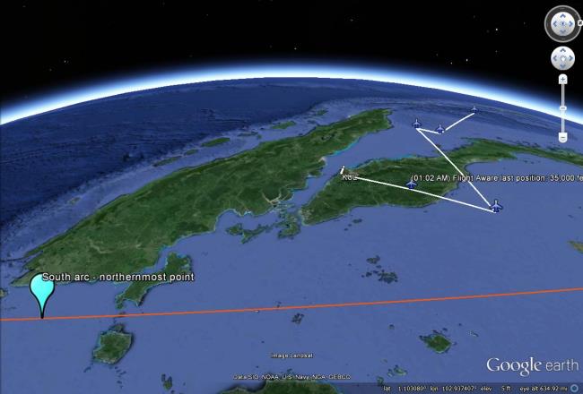
The first few days of the search and rescue operations were concentrated in the South China Sea but as days went by without finding any debris, the search area became much larger. Satellite data analysis indicated that the plane had been airborne for several more hours, which may have meant it had come down in the southern Indian Ocean.
The Role of Technology in the Search
The search for MH370 utilized a wide array of advanced technologies:
- Satellite imagery analysis
- Underwater sonar scanning
- Aircraft-mounted radar
- Ocean current modeling
- Data analytics
Despite these technological efforts, the main body of the aircraft was never located. Only a few confirmed pieces of debris have washed ashore on various Indian Ocean islands and the African coast in the years since.
MH370 Malaysia Airlines On Google Maps
In recent years, several claims have emerged about potential sightings of MH370 using Google Maps and Google Earth. These assertions have garnered significant media attention, particularly from tabloid newspapers. However, it’s crucial to approach these claims with skepticism and understand their context.
The Ian Wilson Claim
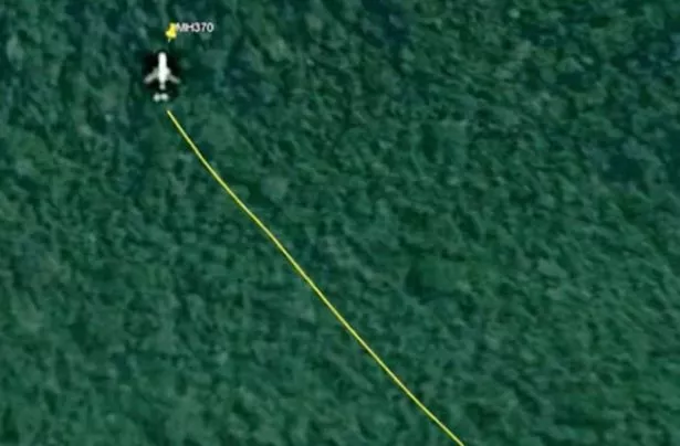
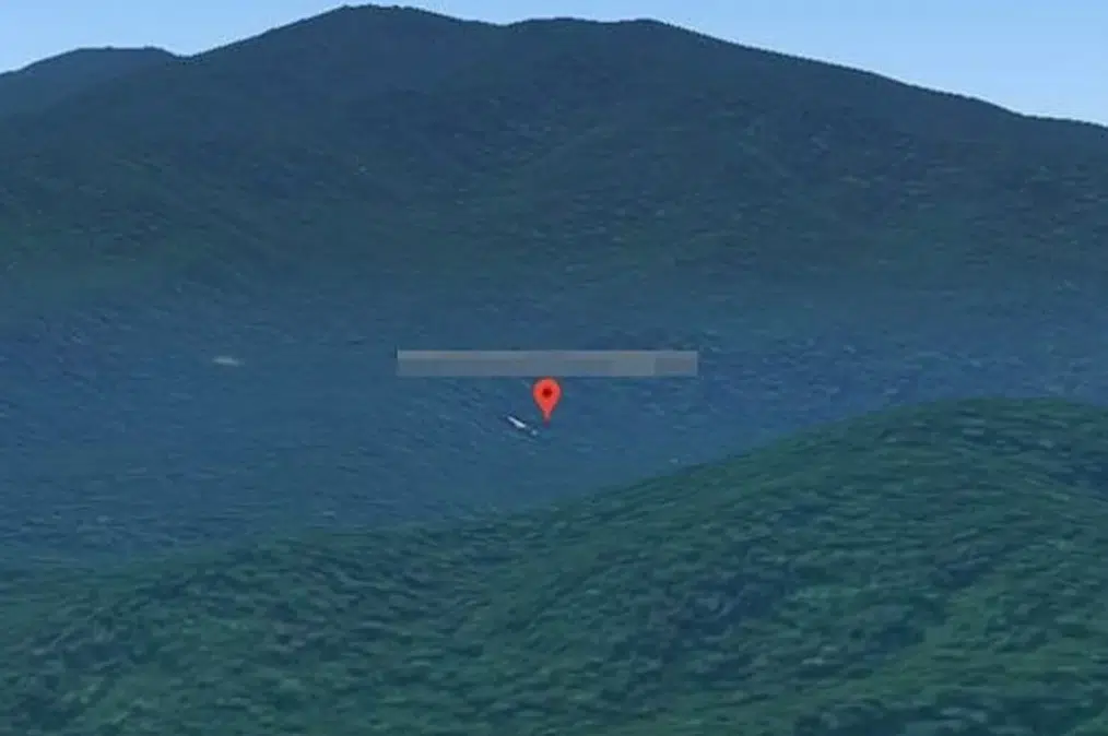
Among the most famous Google Maps sightings the most popular one is the one told by Ian Wilson, a British technology expert. In 2018, Wilson said that he had discovered the wreckage of MH370 in the Cambodian wilderness with the help of Google Maps. He said that he was able to witness what looked like a large aircraft-like shape in a rather empty location.
Wilson’s story was picked up by the media with several British tabloids publishing articles about Wilson’s “discovery. ” He said that he had been searching through satellite images on Google Earth for several hours when he came across what he thought was the crash site.
Analysis of the Google Maps Claim
While Wilson’s assertion generated headlines, several factors cast doubt on its validity:
- Image Date: The satellite imagery Wilson based his claim on predated the MH370 disappearance by several years.
- Official Refutation: Cambodian authorities investigated the claim and found no evidence of an aircraft crash in the area.
- Expert Skepticism: Aviation and satellite imagery experts pointed out that the object’s size and shape were inconsistent with a Boeing 777.
- Lack of Physical Evidence: A ground expedition to the site, which Wilson himself participated in, failed to locate any aircraft debris.
The Challenges of Satellite Imagery Interpretation
The MH370 Google Maps claims highlight the complexities and potential pitfalls of interpreting satellite imagery:
- Resolution Limitations: Publicly available satellite imagery often lacks the resolution necessary to definitively identify small objects or structures.
- Perspective Issues: Objects can appear distorted or misshapen when viewed from above, leading to misinterpretation.
- Natural Formations: Geological features or vegetation patterns can sometimes resemble man-made objects when viewed from satellite imagery.
- Outdated Imagery: Google Maps and Google Earth don’t always display the most current imagery, which can lead to confusion about the timing of observed features.
The Ongoing Search and Future Prospects
Despite the lack of success in locating MH370, efforts to solve the mystery continue:
- Ocean Infinity Proposal: In 2024, Texas-based company Ocean Infinity proposed a new search operation using advanced underwater technology on a “no-cure, no-fee” basis.
- Debris Analysis: Ongoing analysis of recovered debris provides clues about the aircraft’s final moments and potential crash location.
- Data Reexamination: Experts continue to review and reanalyze existing data, hoping to uncover new leads or insights.
- Technological Advancements: Improvements in underwater search technology and data analysis techniques may enhance future search capabilities.
The Impact on Aviation Safety
The disappearance of MH370 has led to significant changes in aviation safety and tracking:
- Real-time Tracking: The International Civil Aviation Organization (ICAO) now requires aircraft to report their position every 15 minutes over open ocean areas.
- Extended Recording: New regulations mandate longer recording times for cockpit voice recorders and flight data recorders.
- Improved Communication: Enhanced satellite communication systems are being implemented to maintain constant contact with aircraft.
- Emergency Locator Transmitters: Research into more robust and longer-lasting emergency locator transmitters has been accelerated.
Sad Side Of The MH370 Incident
Beyond the technical and operational aspects, the disappearance of MH370 has had a profound human impact:
- Families in Limbo: The families of the 239 passengers and crew continue to live with uncertainty and grief.
- Psychological Toll: The prolonged search and lack of closure have taken a significant emotional toll on those connected to the flight.
- Cultural Impact: The mystery has captured global attention, becoming a cultural touchstone for discussions about aviation safety, technology, and the unknown.
The Role of Citizen Investigators
The MH370 case has attracted the attention of the public and citizen investigators and amateur sleuths who have used applications such as Google Maps in their search for clues. These efforts have not yielded the location of the aircraft but they show how the public has been involved in the search and how the use of technology has been made accessible to the public.
But the case of Ian Wilson’s Google Maps claim also shows that such investigations can be rather problematic. These are some of the dangers of such claims that lack context, expertise, and proper verification can give people false hope and spread wrong information.
The Importance of Scientific Rigor
The MH370 investigation underscores the critical importance of scientific rigor and expert analysis in complex search operations. While tools like Google Maps can be valuable for initial leads, they must be complemented by:
- Expert Analysis: Interpretation of satellite imagery and other data by qualified professionals.
- Ground Verification: Physical investigation of potential sites identified through remote sensing.
- Multi-source Corroboration: Cross-referencing findings with other data sources and investigative methods.
- Peer Review: Subjecting claims and findings to scrutiny by the scientific and aviation communities.
The Future of Aircraft Tracking
The MH370 incident has accelerated the development and implementation of advanced aircraft tracking technologies:
- Satellite-based ADS-B: Automatic Dependent Surveillance-Broadcast systems that use satellites to track aircraft globally.
- Space-based VHF: Very High Frequency communication systems with global coverage.
- Black Box Streaming: Real-time streaming of flight data recorder information to ground stations.
- AI-powered Anomaly Detection: Machine learning algorithms to identify unusual flight patterns or behaviors.
These advancements aim to prevent future incidents like MH370 and enhance the ability to locate aircraft in distress quickly and accurately.
Role of Social Media and Information Spread
The MH370 case has also shown how social media can be a force for good and bad in disseminating information – or disinformation – on major incidents. Although social media networks such as Twitter and Facebook have provided means of sharing updates and theories, they have also promoted the sharing of rumors and conspiracy theories.
This is a clear indication that people need to be more media literate and critical thinkers especially in the digital age. This is important especially when the public is in a position to distinguish between the facts and rumors especially when investigations are still underway.
MH370 Malaysia Airlines on Google Maps: The Reddit Investigation
The disappearance of Malaysia Airlines Flight MH370 has been one of the biggest enigmas of the century and people are trying everything to get to the bottom of it. Another interesting element of this research is the application of Google Maps and Google Earth to search for possible crash locations.
This approach has been popular on platforms like Reddit where people work together and post their discoveries, A user by the name of Dirty80s from thailand also said that his son has located MH370 on google Maps and he also posted the Malaysia Airline google maps location link.
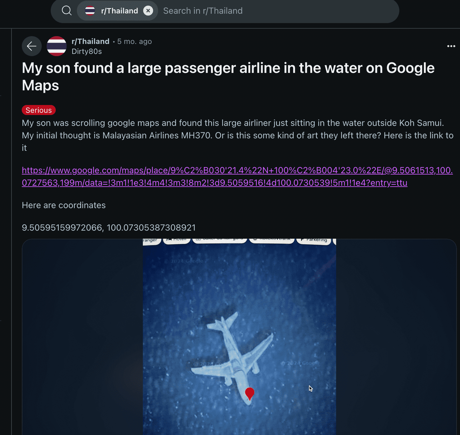
But When we visited the link shared by the reddit user, we have found that the user claims are false.
Reddit’s Involvement
Reddit, especially the aviation and the mysteries subreddits has been a platform of choice for discussing the MH370 sightings on Google Maps. People share the coordinates, images, and theories and discussions ensue and more research is done. This work demonstrates the potential of crowdsourcing as a method of solving various issues.
However, the search for MH370 goes on to the present day, and it is fueled by people’s desire to find the answers. The use of such platforms as Reddit indicates that the public remains interested in the case and continues to seek solutions from the technological front.
The Psychological Impact of Uncertainty
The lack of closure in the MH370 case has had a profound psychological impact on the families of those on board, as well as the broader public. The uncertainty surrounding the fate of the aircraft and its passengers has led to:
- Prolonged Grief: Families unable to fully process their loss due to the lack of definitive information.
- Conspiracy Theories: The emergence of numerous theories attempting to explain the disappearance.
- Trust Issues: Decreased public trust in aviation authorities and governments involved in the investigation.
- Anxiety: Increased anxiety among some air travelers, particularly on long-haul flights over oceans.
Mental health professionals have emphasized the importance of providing ongoing support to affected families and addressing the broader societal impact of such unresolved mysteries.
Final Words:
Malaysia Airlines Flight MH370 still to this date is one of the biggest mysteries that has ever occurred in the aviation industry. Although Google Maps sightings and other speculations have been making rounds on the internet, they have not helped in finding the aircraft. The lessons learned from this tragedy, the search and rescue operations and technological developments that are still ongoing are still felt in the field of aviation safety.
As the world is on the verge of the tenth year since the MH370 incident, the search for the answers goes on. The aviation industry, governments and the families of the passengers on the flight have not waned in their determination to solve this mystery which has defied solution up to this date.
Until concrete evidence is found, the story of MH370 will remain a mystery that will intrigue and puzzle the world, a sad story that is a reminder of the difficulties that exist in providing safety and responsibility in international air travel. The case of MH370 also shows how the public can be involved in the process and at the same time not interfere with the scientific process.
Although the application of tools such as Google Maps has made geographical information more accessible to the public, this also highlights the importance of professionals to analyze and validate the information. Thus, it is necessary to adhere to strict scientific principles in order to find the answers to the questions like the one about MH370, but at the same time, one cannot forget about the people and feelings that are behind such events.