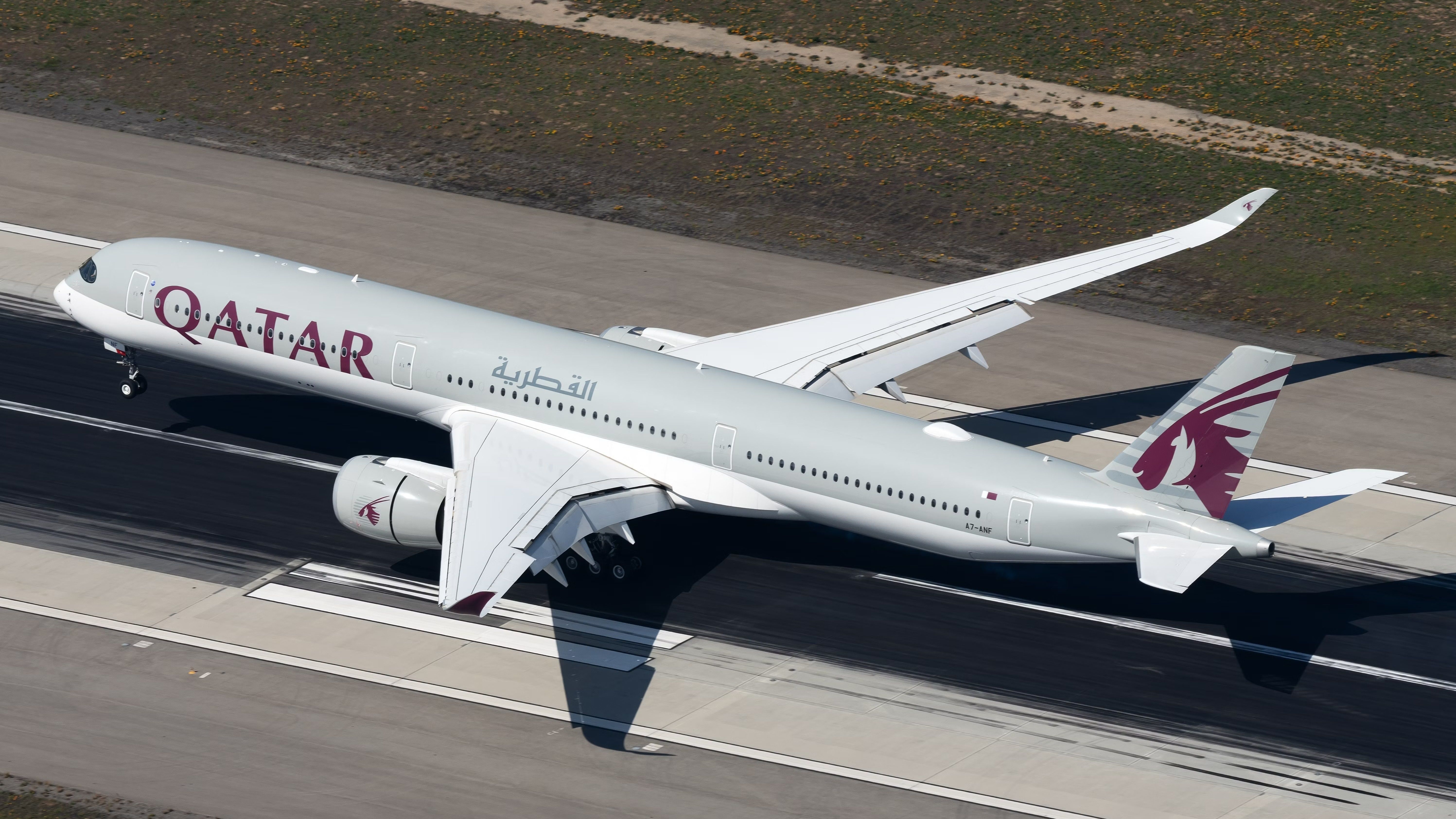
Last summer, I took a flight with my family from our home base in Atlanta to Doha. I asked one of my offspring what she was most excited about for the trip, hoping she might share her father’s enthusiasm for the chance to fly aboard a brand new Airbus A350-1000 with one of the world’s premier airlines. Her response? “I’m excited to look out the window and see all the dunes of the Sahara Desert. Do you know it’s the biggest desert in the world?”
Photo: Vincenzo Pace I Simple Flying
While I did know that fact, I had to disappoint her with the news that we would be flying thousands of miles around the Sahara. Instead, we would be following a Great Circle Route (GCR) and traversing the land of her birth (Scotland) on our 14-hour flight, which offered very little in the way of sand dunes. Knowing her world map and the relative positions of Atlanta and Doha, she looked at me like I was mad. Why would our aircraft fly so far out of its way instead of just directly across the Atlantic and North Africa?

Related
The World’s 11 Busiest Airports With 100% International Flights
While some are obvious, others are less so.
What are Great Circle Routes?
The reason for her confusion is the Mercator projection. Created by Flemish cartographer Gerardus Mercator in 1569, it solves the problem of mapping the three-dimensional sphere that is our Earth onto the two dimensions of our maps. It depicts the Earth as a cylinder, increasingly distorting towards the Poles, and then “rolling out” that cylinder into a flat map.
Photo: Ian Dewar Photography | Shutterstock
As a result, on our maps, we perceive the shortest route between Atlanta and Doha to be a straight, left-to-right line between the two cities (the blue line below). This is also known as the Rhumb line. But if you stretch a piece of string across a globe between those same cities to determine the actual shortest route, it would track along the red line below. This is the Great Circle Route: The shortest path between two points on the surface of a sphere.
Image: Greatcirclemap.com
How are GCRs used in aviation?
If the GCR is the shortest distance between two points on the Earth, it logically follows that aircraft navigation systems will use this as their starting point when calculating a flight path between those two points. Excluding other mitigating factors, the GCR will provide the shortest flight time, thereby minimizing fuel burn and getting passengers to their destination quicker.
If you are a regular reader of Simple Flying, you will also have seen many “Longest flights from X” articles, and we calculate the distance of those routes using GCR. Indeed, the current rankings of the world’s longest flights (see below) are determined according to GCR rather than flight time or the ground distance traveled.
|
Longest scheduled commercial routes (February 2025) |
||||
|
Rank |
Route |
Airline |
Aircraft |
Distance (GCR) |
|
1 |
Singapore – New York JFK |
Singapore Airlines |
A350-900ULR |
15,349 km; 9,537 mi |
|
2 |
Singapore – Newark |
Singapore Airlines |
A350-900ULR |
15,344 km; 9,534 mi |
|
3 |
Doha – Auckland |
Qatar Airways |
A350-1000 |
14,535 km; 9,032 mi |
|
4 |
Perth – London Heathrow |
Qantas |
Boeing 787-9 |
14,499 km; 9,009 mi |
|
5 |
Melbourne – Dallas |
Qantas |
787-9 |
14,472 km; 8,992 mi |
|
6 |
Perth – Paris |
Qantas |
787-9 |
14,264 km; 8,863 mi |
|
7 |
Auckland – New York JFK |
Air New Zealand |
787-9 |
14,207 km; 8,828 mi |
|
8 |
Dubai – Auckland |
Emirates |
A380-800 |
14,200 km; 8,823 mi |
|
9 |
Dubai – Auckland |
China Southern |
A350-900 |
14,147 km; 8,791 mi |
|
10 |
Singapore – Los Angeles |
Singapore Airlines |
A350-900 |
14,114 km; 8,770 mi |
Do flights always follow GCRs?
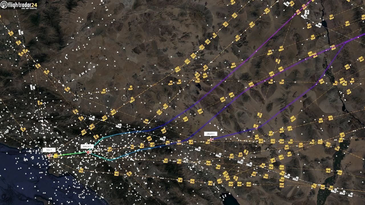
While the distances listed for these flights are the exact GCR, in reality, the flight will usually cover a longer ground distance because they rarely fly in a perfectly straight line. Most air navigation systems today rely on ground stations and airways with aircraft required to pass over waypoints, which helps ATC to space aircraft, especially in congested areas. As a result, most flights are a series of connected sectors that roughly track along the GCR.
Photo: Flightradar24
There are also numerous other reasons that a flight might not follow the GCR exactly:
- Jet streams: The most common reason for deviating from the straightest route is that pilots adjust their flight paths to take advantage of favorable jet streams. A strong tailwind can not only positively impact flight speed, getting you to your destination sooner, but greatly adds to fuel efficiency.
- Weather: Hurricanes, severe storms, or areas of turbulence can force pilots to detour around bad weather, even if it means flying a longer path.
- Airspace restrictions: Certain airspace may be restricted due to political issues, military activity, or other factors, forcing flights to take alternative routes. Examples of this today are the restricted airspaces over Russia and Ukraine.
- Overflight costs: Less likely, but it is possible that an aircraft may choose to divert from a GCR to avoid the overflight charges of a particular state.
- ETOPS rules: Smaller twinjets might have ETOPS restrictions on how far they can fly from a diversionary airport, and don’t follow a GCR so they can stick closer to land.
Photo: jremes84 | Shutterstock
You can see the impact of these factors on some of the world’s longest flights. For example, the two Singapore Airlines flights to New York-JFK and Newark have a GCR near the North Pole of approximately 9,540 miles (15,350 km). But outbound to the US, they will typically fly a ground distance of around 10,720 miles (17,250 km) over the Pacific Ocean, where jet streams can assist. Similarly, on the return leg, they sometimes forego the Polar route to fly eastward across the Atlantic to take advantage of favorable jet streams, for a ground distance of 10,300 mi (16,500 km).
Photo: Markus Mainka | Shutterstock
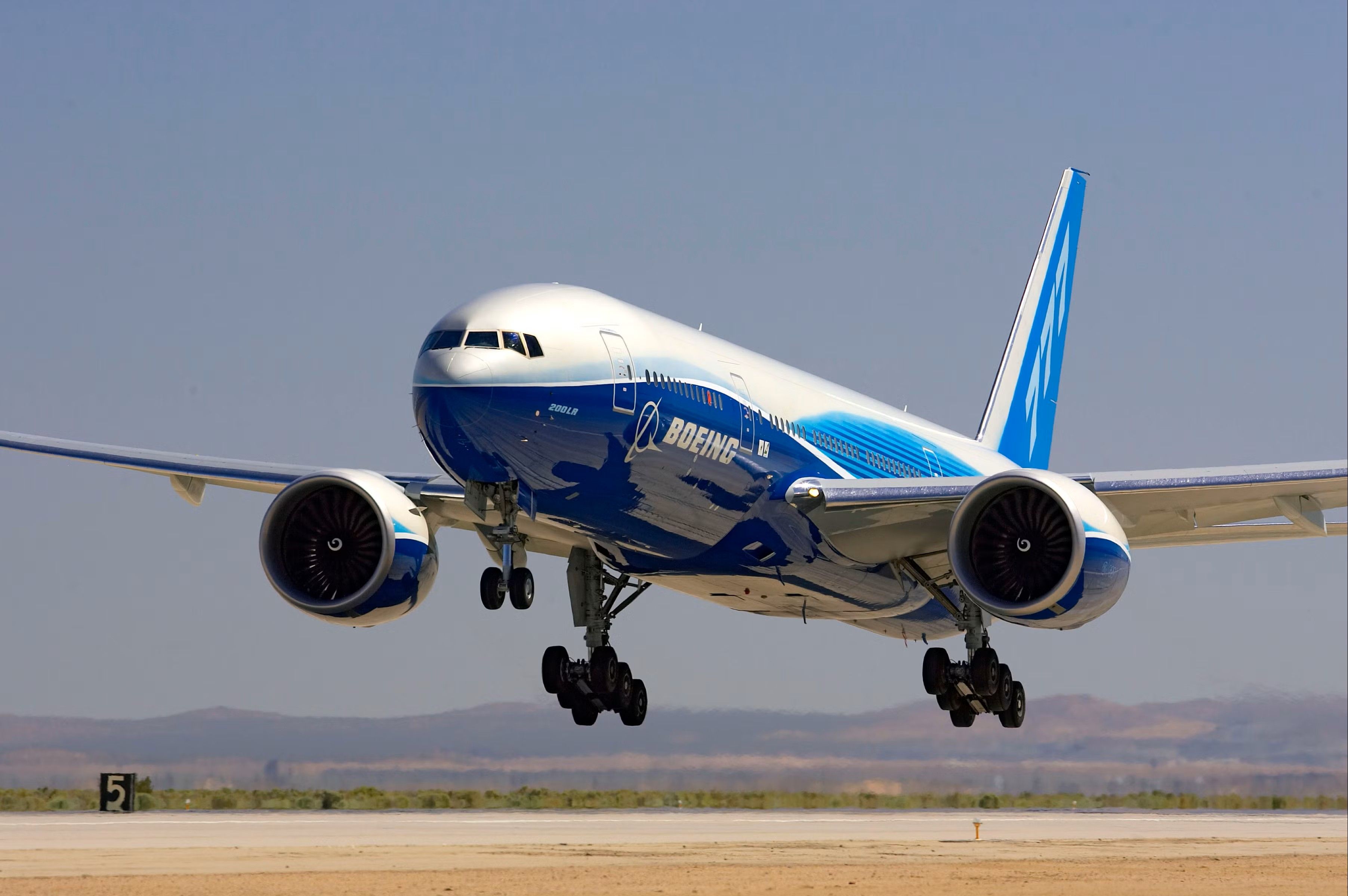
Similarly, Air India’s twice-daily 777-200LR flights from New Delhi to San Francisco fly an eastward ground distance of about 9,390 mi (15,110 km) over the Pacific Ocean instead of a shorter westward GCR of about 8,300 mi (13,300 km) to take advantage of tailwinds and avoid prevailing westerly headwinds, thereby saving almost two hours of flying time. Indeed, the world-record flight of ‘Baby Blue 2’, a 777-200LR that flew the “wrong way” from Hong Kong to London, relied on these same tailwinds to be able to make the distance.
Related
The Story Of Baby Blue 2: Commercial Aviation’s Longest-Ever Nonstop Flight
The flight from Hong Kong to London, the ‘wrong way round’, remains the longest-ever flight by a commercial aircraft.
NATS: Designated lanes on the GCR highway
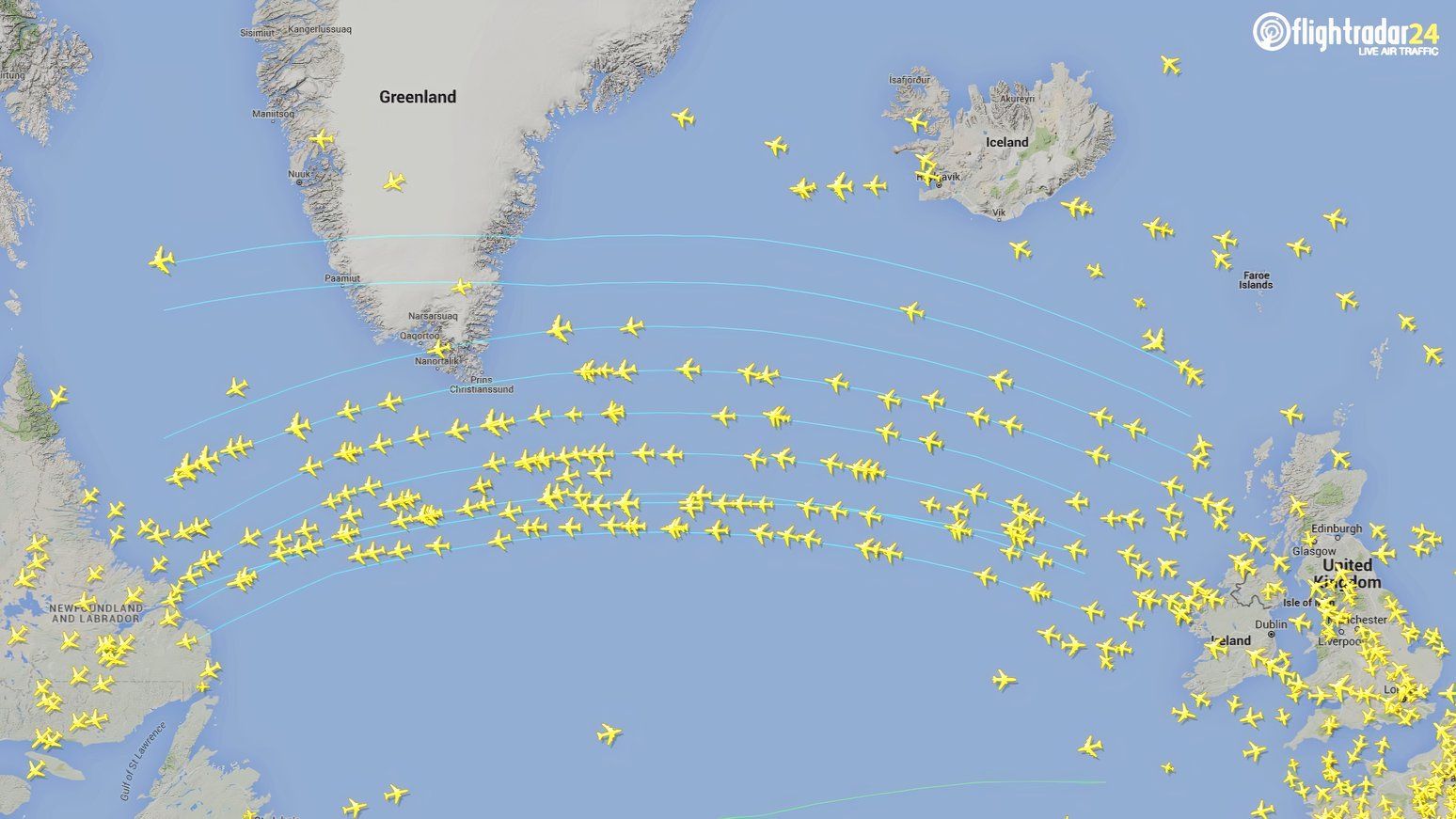
In some cases, finding the balance between GCRs and the most efficient flight paths is regulated. The best example of this is the North Atlantic Tracks (NATs), the pre-determined flight routes across the North Atlantic established daily to optimize the flow of transatlantic air traffic. They align with GCRs, but take into consideration the prevailing wind patterns and, most importantly, the jet streams, to ensure that flights are as efficient as possible.
Photo: Flightradar24
The NATs are coordinated by air traffic control organizations such as the FAA and the National Air Traffic Services in the UK. Each day, a series of routes is published, taking into account factors like weather conditions, airspace congestion, and safety considerations. Airlines then select the most suitable track for their flights based on departure times, aircraft performance, and fuel efficiency goals. The NATs vary daily, exemplifying how GCR principles are applied in real-world aviation to improve operational efficiency.
A new transatlantic speed record
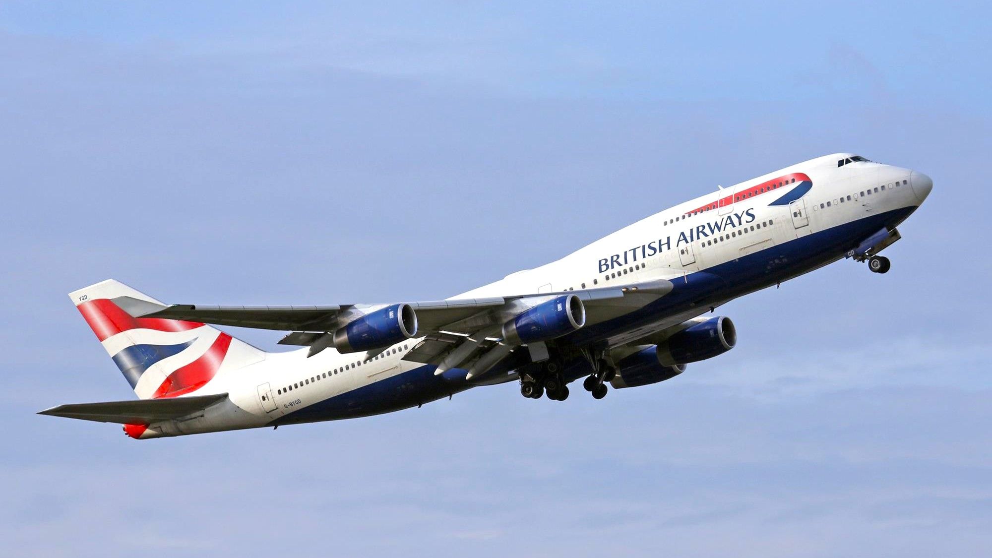
The use of the North Atlantic Tracks, combined with advancements in aircraft technology and optimized flight planning, has led to record-breaking flight times across the Atlantic in recent years. In February 2020, a British Airways 747-400 flying from New York-JFK to London Heathrow set a new record for subsonic flight, completing the journey in under five hours.
Photo: British Airways
The quadjet, at its fastest, exceeded a ground speed of 800 miles per hour, according to global flight-tracking service Flightradar24. British Airways confirmed that the flight took four hours, 56 minutes, beating the previous record from 2018 that was set by Norwegian, which flew from New York to London in five hours, 13 minutes.
Flightradar24’s Ian Petchenik had the following to say about the record:
“That was the first time that we’ve seen a subsonic crossing in under five hours, but it won’t be the last. These increased speeds across the Atlantic are happening on a fairly regular basis, especially in the winter when the jet stream dips down into where the North Atlantic Tracks are and is a bit stronger. Of course, the flip side is that westbound flights have to deviate substantially to avoid the headwinds, increasing flight times to the US east coast significantly.”
Photo: Markus Mainka | Shutterstock
If you enjoy math, this last section is for you. But if memories of high school trigonometry bring back nightmares for you, skip to the discussion that follows the article…
Great circle routes are calculated using spherical trigonometry. The formula involves calculating the central angle between two points on the Earth’s surface, which is determined by the latitude and longitude of both locations. The central angle, denoted as Δσ, is found using the following formula:
Δσ = arccos(sin(φ1) * sin(φ2) + cos(φ1) * cos(φ2) * cos(Δλ))
Where φ1 and φ2 are the latitudes of the two points, and Δλ is the difference in longitude between the two points.
Once the central angle is known, the great circle distance can be calculated as:
d = R * Δσ
Where d is the distance along the great circle, and R is the Earth’s radius.

Related
The Long Way Round? Why Flight Paths Are Curved
Have you ever wondered why flight paths on flyers and maps appear curved?

